
Club Archive
This is a new area with photos from 2009 - 2023, a brief history on Peterhead Bay and a historical photo gallery related to the club and bay
Photos through the years
Click each year to see photos from that year!


-
in 1593 the construction of Peterhead's first harbour, Port Henry basin, began in the bay. In 1773, civil engineer John Smeaton built the south harbour, which was originally called Sackit-hive. In 1808, civil engineer William Wallace was appointed, on the recommendation of Scottish civil engineer John Rennie to build the north harbour. Wallace's task was to deepen the harbour, create a quay wall on the west pier and use any waste material to create a new embankment.
-
Criminals who were given Hard Labour prison terms in Scotland in the 1800’s had to be sent to England to serve their sentences because Scotland had no convict prisons. On 30th September 1864 convicts escaped from a special railway carriage at Crewe on the way to an English prison. Scotland needed its own convict prison and in 1884 the Peterhead prison was started. Once the build was completed, the harbour project started to build the bay of refuge and the idea was put forward to use prisoners from the convict prison (completed in 1888) and have them risk their lives working on the construction of the harbour and so with that construction started and they were put to work mining granite from the Stirling-hill quarry and building the breakwater . A railway system was established in order to transport granite from the quarry to the harbour. It was also used in order to safely transport prisoners. The prisoners had to stop work in 1949, 7 yers before the project finished, as hard labour was abolished from prisons. The breakwater was finished in 1956
-
Every block placed, and foundation poured, had to be supervised by divers. Each diver relied on a team to back him up. His life depended on them. The suddenness of stormy weather hampered the progress. Divers could only operate from May to September. Two world wars also occurred. From 1889 to the last main block laid on 27th September 1956 and completion of the round towers in 1959/60 was a full 70 years' work - and 100 years since the project was first mooted. Although the project was finalised in 1956 the harbour was used well before that to provide shelter from the dangerous “German sea”! Looking at the breakwaters today, they seem unremarkable, but in reality they are an amazing achievement. Only a few feet on these harbour walls are visible at high tide, but at the harbour mouth the water is more than 10 fathoms deep. That is 60+ft or five double decker buses. And they are three quarters of a mile long. It is estimated that about half a million tons of granite was used.
-
Peterhead was used for operational flights when the level of the Loch of Strathbeg dropped below a safe depth. The Peterhead based partly 3.6 hectares of re-claimed ground largely made up of granite debris and rubble from the Admiralty yard for the construction of the “harbour of refuge”, at the southern end of Peterhead Bay. An area of foreshore to the northwest of the base was included within the boundary of the station. The breakwaters of the harbour provided a large area of sheltered water for seaplane landings. In 1918 the Peterhead base was to comprise one seaplane shed measuring 61m by 30.5m, with a workshop in an annexe measuring 61m by 6m, and stores for parts, fuel and ammunition. The establishment of the base was 77, of whom five were women, to be accommodated in buildings located in a separate area to the north, on the site of a former brickworks. It is not clear whether the base was completed before it was abandoned in 1919. Nothing remains of the base.
-
A deep water Harbour of Refuge was created by building massive breakwaters across Peterhead Bay. Even large ships can find deep water shelter from storms in the North Sea (called the German Sea when the project started). Huge Titan Cranes set each concrete and stone block in place as the breakwater slowly grew. It was completed in 1956 and the quarry closed.
-
Our history dates back to when the old Buchan Yacht club operated out of the bay in the 1960s, long before the Marina was built. We have our clubhouse, built-in 1995, which provided modern facilities as well as a good place to meet socially or watch the sailors in action. This is still here today as-well as the lido and leisure bay which are all well used by our sailors!
-
When the project was proposed, most ships were at the mercy of the wind and waves. By the time it was finished wind powered ships had given way to to diesel Powered ships which did not need a harbour of refuge. Even during the two world wars the harbour was little used. But luckily in the 1970's oil crisis, everything changed . Finally the harbour earned its keep and justified its massive cost. Total Oil built a tanker jetty to take Natural Gas Liquids from the St Fergus plant. When this finished, tankers used it to supply fuel to Peterhead Power Station. Offshore supply boat bases were built at the root of both north and south breakwaters making Peterhead a significant oil industry base at a time when other industries were failing.
Peterhead Bay and Marina History
Historical Photos
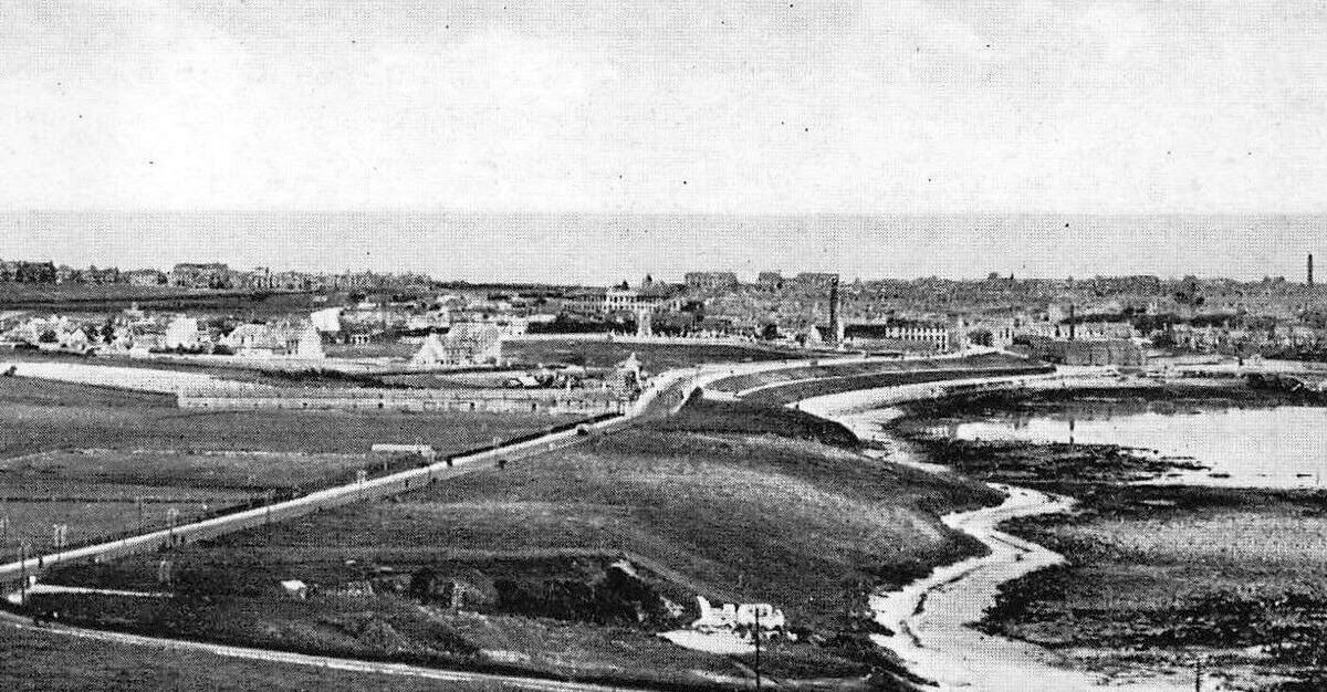
Peterhead Bay Beach Looking North West

Sea Plane Launching In The Bay Of Refuge Where The Marina Now Sits

Historical Map Of The 'Marina'

Photo From Before 1999 With No Marina

Photo From Before 1999 With No Marina

Bay Of Refuge With Oil Rigs

Bay Of Refuge Without Marina and Princess Royal Jetty

Newly Built Marina - With Our Committee Boat And Pioneer

Building Of The South Breakwater

Building Of The South Breakwater

PrisonersWorking In Stirlinghill Quarry

More Recent Club Activity With Only One Marina Wall

Our Slipway Being Uncovered From Sand
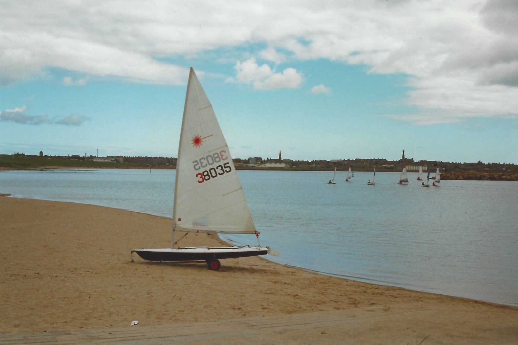
More Recent Club Activity With Only One Marina Wall

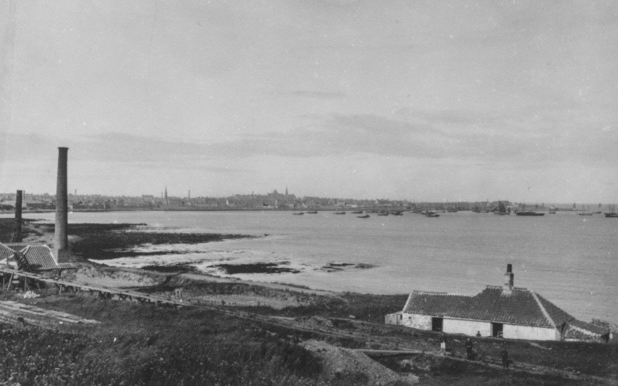
Old Image Of The Fishing Harbour

Marina And Playpark - Now Where Symposium Sits

Old Image Of Brickwork Bay

Old Image Of Brickwork Bay
Old Image Of Brickwork Bay With Brickwork Factory

Old Crane Used In The Construction Of Breakwaters

Expansion Of Fishing Harbour

StirlingHill Quarry Where Rock Was Mined For Breakwaters

Work Continues On Bay Of Refuge

Final Block Placed On North Breakwater In 1956

Prisoners Forced To Work On Rock From Stirlinghill Quarry

Drone Shot Of The Sailing Club From 2000's

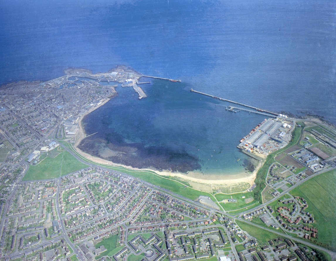
Helicopter Shot From Before The Breakwaters With The Old Fishing Harbour In View

Work Continues On Breakwater Tower

More Recent Image With Full Carpark
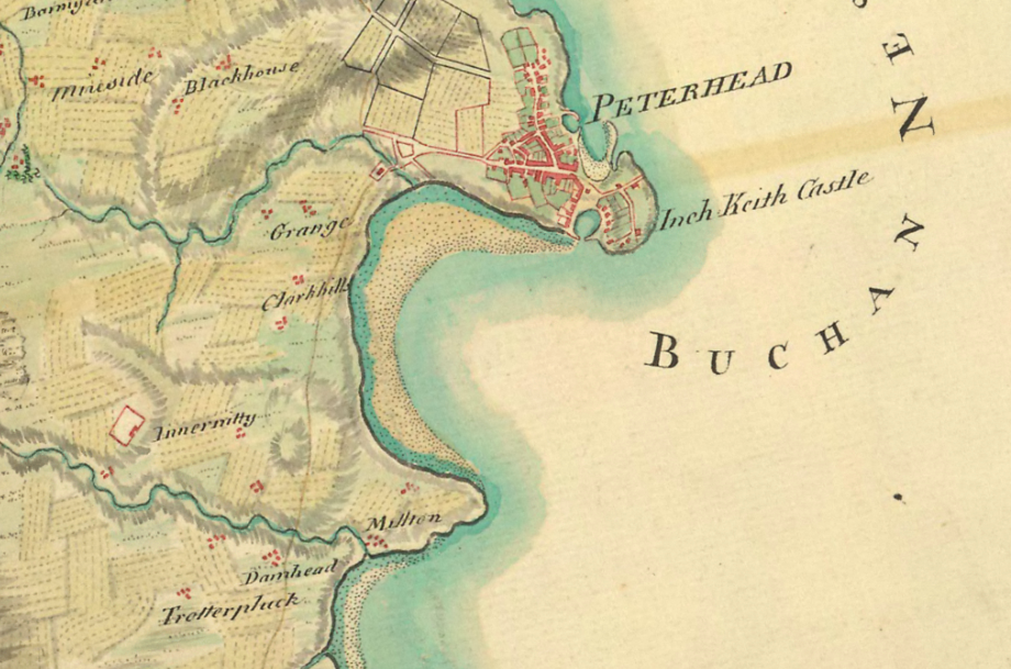
Historic Map Showing Bay Of Refuge

Modern And Historic Map Showing Bay Of Refuge

Construction Continues On The Breakwaters

Breakwater Over Spilling During Construction
We love seeing your photos! Please share them with us via our facebook or email, if you wish to share them with us.
Sources:
Maud Museum, Aberdeenshire
Peterhead Prison Museum
Aberdeenshire historical records
peterhead sailing club
Aberdeenshre council
peterhead port authority
Peterhead trail
McLaughlin & Harvey
National library of Scotland
Bing maps
national collection of aerial photographs
We rely on secondary sources to collate all the info/ images provided, please email us for removal